


About us
Negotiations for the Self-Government Agreement take place through the Treaty and Intergovernmental Relations Department. This approach reflects a commitment to unity and inclusion, ensuring the treaty is part of our community and its ongoing administration work.
Wei Wai Kum First Nation is a part of the Liǧwiłdax̌w Nation. As Liǧwiłdax̌w people, we have a shared history, ancestors, and language. Our territory spans from the north end of Johnstone Strait to Qualicum River in the south. Currently, there are three Liǧwiłdax̌w Nations recognized as Indian Act “bands”: Wei Wai Kum, Kwiakah, and We Wai Kai. In the past, there were several other Liǧwiłdax̌w groups that have amalgamated with these three nations.
We are committed to negotiating a Self Government Agreement that recognizes our rights and title, and confirms our jurisdiction and decision-making authority.
Our Mission
To build a future protecting the rights and title of Wei Wai Kum members, rooted in the desires of the community.
Our Vision
Self-governance in unity with cultural, social, and economic capacities for our members.
Our Values
Collaboration: Foster leadership and teamwork at all levels.
Respect: Demonstrate efficiency and consistency in our communications and meetings with others.
Transparent: Be clear and straightforward with messages during negotiations with members.
Accountable: Be reliable and demonstrate objectivity.
Meet The Wei Wai Kum Treaty Team
The Treaty Team is equipped with a wide array of knowledge and expertise that we bring to the table. We harness distinct specializations and skill sets to advance the Nation’s interests. Above all else, we aim to be community-informed and guided.

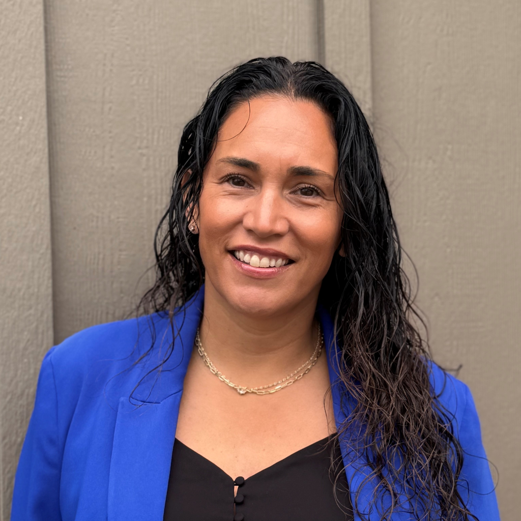
Chief Councillor Chris Roberts
Chief Negotiator and Elected Chief Councilor
Chris Roberts was elected as the Wei Wai Kum Chief Councillor in 2018. Chief Roberts was born and raised in the Wei Wai Kum community and later earned an Economics Degree from UVic in 2008. Chief Chris is married to a We Wai Kai member and has two beautiful children.

Robert Dennis
Advisor to Chief Counsellor
Robert has an extensive background in treaty negotiations and implementation from his experience as the Chief Negotiator for the Huu-ay-aht in the Maa-nulth Treaty. Notably he was elected as the Chief Councillor of his Nation for over two decades. Prior to this, he served as an elected Councillor and the Huu-ay-aht Band Manager. Robert fulfilled a role as the hereditary speaker for Tayii Ḥaw̓ił ƛiišin, which his son now holds for the head hereditary chief.

Tony Roberts Jr.
Wei Wai Kum Councillor
Tony Roberts Jr. has been an elected Councillor for many terms with extensive experience in fisheries negotiations.

Lorraine Henderson
Wei Wai Kum Councillor
Nadgelin Cliffe
Director of Treaty & Intergovernmental Relations
Nadgelin is a member of Wei Wai Kum and brings over a decade of experience in treaty negotiations. She has specialized expertise in finance and administration and is committed to strengthening governance and Constitution engagement. Nadgelin also contributes her leadership as a board member with several organizations.

Dakota Nelson
Treaty Legal Intern
I am Musgamagw Dzawada’enuxw from Kingcome Inlet and Tahltan from Telegraph Creek. I am in year two of the JD/JID Joint Degree Program in Canadian Common Law and Indigenous Legal Orders at the University of Victoria.
I joined the Treaty Department as a Legal Intern to support work with the Constitution and other agreements.

Tasia Dick
Administrative & Outreach Coordinator
Tasia Dick serves as the Administrative and Outreach Coordinator in the Department of Treaty and Intergovernmental Relations. With over seven years of experience in the Administration Office, Tasia brings a strong sense of dedication, organization, and community connection to her role.
She is deeply committed to engaging with members and building meaningful relationships—making daily connection with the community a cornerstone of her work.
Outside the office, Tasia enjoys spending time with her husband, Ivan, and their son, Tavan. Along with their dog, Gouda, they enjoy playing sports and embracing new adventures together as a family.

Carolyne Hoogenraad
Treaty Engagement
A proud Wei Wai Kum member and part of the Roberts family, Carolyne Hoogenraad lives in South Surrey with her husband, John. Her three daughters–Somer, Jade, and Paisley–have all left the nest and are now thriving in downtown Vancouver.
Carolyne has been an active presence at Treaty dinner meetings, WWK Days, and AGMs, and has served on the Constitution Committee since 2023. She brings a deep passion for learning, connection, and community-building. Carolyne is excited to support the Treaty team and help strengthen ties with members living away from home, fostering a greater sense of belonging and a deeper understanding of our Treaty and Constitution.

Caroline Roberts
Legal Council: Callison Hanna Law
Caroline, a member of the Wei Wai Kum Nation, was called to the bar in 2017 and is an associate at Callison & Hanna. Her professional practice focuses on consultation and accommodation, as well as specific claims and treaty negotiations.

Treaty Team
- Murray Browne, Legal Counsel, Woodward & Co.
- Dee Cullon, Anthropologist
- Larry Fedorkie, Forestry Advisor, Capacity
- Harmony Johnson, Governance Advisor
- 50th Parallel, Communications
For general inquiries, please contact treaty@weiwaikum.ca
Our History
Homayno Indigenous Protection and Conservation Area
On June 21, 2024, National Indigenous Peoples Day, the Wei Wai Kum Nation declared the Hamayno Indigenous Protection and Conservation Area (IPCA) in Loughborough Inlet on British Columbia’s South-Central Coast. Homayno has sustained the Wei Wai Kum people for thousands of generations. This is evident in the former village sites, cultural, and spiritual sites in and around Homayno.
Watch the video to learn more.
ʔuxstalis (Tyee Spit)
The rich history of ʔuxstalis, known to many as Tyee Spit, is a testament to the resilience and heritage of the Liǧʷiłdax̌ʷ people.
This landmark holds deep cultural and spiritual significance for the Wei Wai Kum people. The City of Campbell River acknowledges the historic injustices that led to the loss of this sacred land and supports its return to the Nation as part of ongoing reconciliation efforts. This shared commitment reflects a path forward grounded in respect, healing, and renewed relationships. Learn more on the City of Campbell River website.
Listen to the history.
Wei Wai Kum is part of the Liǧwiłdax̌w Nation. As Liǧwiłdax̌w people, we share a common history, ancestor and language and our territory extends from the north end of Johnstone Strait to Qualicum River in the south. Today, there are three Liǧwiłdax̌w nations that are formally recognized as Indian Act “bands”: Wei Wai Kum, Kwiakah and We Wai Kai. Previously there were numerous other Liǧwiłdax̌w groups who have amalgamated with these three nations.
In Liq̓ʷala, the word Liǧwiłdax̌w refers to a large sea worm that cannot be easily killed. If it is cut up, the separate pieces survive and will swim away. The term therefore means “unkillable thing” (Curtis 1970 [1915]:308).
According to liǧwiłdax̌w oral history, Weqaʔyi (pronounced We-kay) is the first ancestor of liǧwiłdax̌w people. His story begins at Təka (pronounced Tik-ya), located at Read Bay, in Topaze Harbour. This story, which Boas referred to as the “ancestor legend” (Boas 2002:297), explains our origins as liǧwiłdax̌w and many of the cultural rights and traditions we and other liǧwiłdax̌whold today. It was recorded by Boas (Boas 2002:30) in the late 1800s.
An important period associated with Weqaʔyi was the flood, of which he was warned in his dreams. To prepare for the deluge that was coming Weqaʔyi made a cedar bark rope that was many metres long and tied it to a rock on the mountain next to Təka. Then he carved canoes, loaded them with supplies and tied them to the mountain. When the flood came, the waters rose, not with rain, but more like an incoming tide. And according to the name, gʷakanaquʔela (“water never came over the top”), the mountain rose along with the flood, for Weqaʔyi was a powerful man. Some of the canoes were cut loose and floated to become or join with other Nations, but the canoes that remained held the survivors who are the ancestors of Liǧwiłdax̌w people.

Although there are many ways to tell the story, the general outline remains the same. Billy Assu told the story to anthropologist Phillip Drucker in 1953. He said:
The first man came down at Topaze Harbor, Weqaʔyi was his name and Təka was the name of the place. There is a mountain there named Lakatisin and after a long time the flood was to come. Expecting the flood “they” made cedar rope that stretched from the top of the mountain to the salt water. Then he fastened two canoes together and the flood came and it lasted a long time. Weqaʔyi cut some of the people loose [in canoes] and these people landed elsewhere to start neighbouring Nations (i.e. Kitimat). Then the water started to recede and Weqaʔyi started to traveled to other places. He went to Knights Inlet and met a woman there named Lthantaq who had wings on her back and claimed the river as her own. Weqaʔyi put stakes in the river, which resulted in an argument which resulted in Weqaʔyi building a house at Knights Inlet and making grease every spring. After a while, Weqaʔyi called people from all over and he used his grease to buy slaves. Then Weqaʔyi lived at Hwulk, the Nimpkish River. Eventually, he married a woman from Gilford Island named kehwukanux. It was while living here that Weqaʔyi acquired coppers. Sometime later Weqaʔyi learned about Bella Coola, where he traveled to by a trail from Knights Inlet. Along the Bella Coola River, he met a man named Nuxhwults, who was sad because his fish dam [fish weir] was broken. Weqaʔyi fixed the weir using hardwood stakes and in return, he was given one of Nuxhwults’ daughters, a cape with shining shells, named milkestsala’yu, and a hat. When Weqaʔyi returned to Hwulk, he gave these gifts away. Then Weqaʔyi travelled to the west coast of Vancouver Island, marrying there and acquiring wolf dances. Finally he travelled to Rivers Inlet, marrying again to obtain the tsitseqa dances [red cedar bark and hamatsa dances].
As the story says, following the flood, Weqaʔyi and his people spread north-, east- and westward from Təka. Over time the larger liǧwiłdax̌w group divided into subgroups. Wilson Duff, an anthropologist, recorded five separate divisions of the liǧwiłdax̌w: the Wewaikai; Weiwaikum; Kwiakah; Tlaaluis; and Hahamatsees. Galois (1994:223) suggests that there were at least seven divisions and adds the Komenox to the list. Boas (1966:37) records five: Weweqe, XaxamatsEs, Kwexa, Tlaluis and Q!omenoxw. Tolmie in 1835 (317) notes five groups: Leequeeltanock, Weeweewk, Weweeakum, Thlaluisala and Kowmoochsheah. And Dawson in 1887 (3) records Walitsum, Wiweeke, Kwiha, Wiweekum and Awaoo. Of the Weweekum and Awaoo, he says they joined together under one tribe (Dawson 1887 )

Long after the flood and Weqaʔyi expansion of our territory and prerogatives, we further expanded our territory southward. This was done by building alliances but also during a long conflict with our Coast Salish neighbours to the south. This conflict was ongoing before 1792 when the first European ships appeared in our territory. This conclusion is based on the presence of fortified Salish villages recorded in 1792 by British and Spanish ships. For example, in 1792 the Britons and Spaniards met Salish-speaking people at Cape Mudge. They were living in a fortified, defensive site on the bluffs at the south end of Quadra Island. The height above water and difficult access to this village site suggest that the people here were under threat from our ancestors who lived to the north. Meade (Meade 1962:37) refers to the village as a “bastion or citadel.” But let’s remember that this conflict was two-sided and while we were successful in expanding our territory, it came at a great cost to Liǧwiłdax̌w. The Hudson Bay men at Fort Langley armed the Salish saying that “the more we (Hudson’s Bay Company) promote the ruin of that detestable tribe [Liǧwiłdax̌w], the more effectually we secure the good faith of those nearer home [Fort Langley], & convince them of the acquisition they have gained by the Establishment (April 24, 1829, Maclachlan and Suttles 1998:111). In this way, the Hudson’s Bay workers at Fort Langley supported the Salish in the conflict against
The Salish people at the mouth of Bute Inlet also lived in a fortified village. For the rest of Desolation Sound, Vancouver’s journal says that although there were signs of people, the region was largely uninhabited and there were only some fires seen. Vancouver’s journal (1984:606) describes the village at the entrance to Bute Inlet: “situated on the face of a steep rock, containing about one hundred and fifty of the natives, some few of whom had visited our party in their way up the channel, and now many came off in the most civil and friendly manner, with a plentiful supply of fresh herrings and other fish, which they bartered in a fair and honest way for nails.” The description of the village, on the steep rock suggests that it too, like at Cape Mudge, was placed in a protected and defensible place. “The drawing [of this village] shows housefloors overhanging the edges from the top of the slope, representing another instance where plankhouses were situated in defensible locations” (Angelbeck 2009:207).

The Spaniards were also in the vicinity of Arran Rapids for several days as they attempted to sail through. These waters are treacherous and unpredictable with strong tidal currents. The Spaniards tried many times to navigate the narrows before finally making it through. The Salish were often around the ship and when they saw another canoe approaching, they “immediately went to investigate it and came with them, indicating that they were friends” (Galiano et al. 1991:163). This indicates that they were in an area that was potentially dangerous for them, suggesting they had ventured out of Salish territory. Also, in the vicinity of Cordero Channel, the Spaniards noted seeing a “canoe larger than any we had seen thus far, which crossed from one shore to the other and did not turn to let us see it” (Galiano et al. 1991:166). It is very possible that this was a Liǧwiłdax̌w canoe, as we were well known for our large canoes. We Wai Kai Elder, Billy Assu, even said that our large canoes were polished and smoothed like water (Meade 1965) so, according to Father Demers (who wrote in 1841), the canoes would blend in with the water (Demers 1956:99).
After many years of southward movement our territory came to include from Port Neville south to the Discovery Islands, Discovery Passage, Desolation Sound and the Gulf of Georgia. It is these waters and the adjacent lands that we are negotiating over as we not only seek to reclaim our title lands but also our decision-making authorities over them. Gilak̓asl̓a.


About The Speaker
Nugʷaʔəm Numnasoga
My English name is Nancy Henderson (neé Moon). My paternal grandparents are Chief Johnny Moon and Annie (neé Charlie) of the Walitsama Band (Salmon River) of the Liǧwiłdax̌w Nation and my parents were Dave and Daisy Moon. I am one of nine children. I am married to James K. Henderson, and we have one son, Jim Jr. (Sandi) and one grandson, Rylee, and one step-grandson, Anthony. We also have one daughter, Mary. I am a former member of the We Wai Kai First Nation, and when I married my husband I became a Wei Wai Kum member. I worked as an Administrator for 13 years for the Wei Wai Kum First Nation and as an Administrator for 8 years with the Laich-Kwil-Tach Treaty Society.
References
2009 ‘They Recognize No Superior Chief’: Power, Practice, Anarchism and Warfare in the Coast Salish Past. PhD Dissertation. Vancouver: University of British Columbia.
2002 Indian Myths & Legends from the North Pacific Coast of America : A Translation of Franz Boas’ 1895 Edition of Indianische Sagen von der Nord-Pacifischen Küste Amerikas. Randy Bouchard and Dorothy Kennedy eds. Translated by Dietrich Bertz, Vol. Book, Whole. Talon Books, Vancouver.
1970 [1915] The North American Indian. Vol. 10, Vol. Book, Whole. Plimpton Press, Norwood, Mass.
1887 Notes and Observations on the Kwakiool People of the Northern Part of Vancouver Island and Adjacent Coasts, made during the Summer of 1885: Proceedings and Transactions of the Royal Society of Canada for the Year 1887: Vol. 5. Dawson Brothers, Publishers, Montreal.
1887 Notes and Observations on the Kwakiool People of the Northern Part of Vancouver Island and Adjacent Coasts, made during the Summer of 1885: Proceedings and Transactions of the Royal Society of Canada for the Year 1887: Vol. 5. Dawson Brothers, Publishers, Montreal.
1956 Extract from a Letter of Mr. Demers to Monseigneur of Juliopolis, Dated from Cowlitz, 10 November, 1841. In Notices & Voyages of the Famed Quebec Mission to the Pacific Northwest being the corresponence, notices, etc. of Fathers Blanchet and Demers, together with those of Fathers Bolduc and Langlois. Containing much remarkable information on the areas and inhabitants of the Columbia, Walamette, Cowlitz and Fraser Rivers, Nesqually Bay, Puget Sound, Whidby and Vancouver Islands while on their arduous mission to the engages of the Hudson’s Bay Company and the pagan natives, 1838-1847. Translated by Carl Landerholm, pp. 98-109. Book, Section vols. Oregon Historical Society, Portland.
1953 Fieldnotes of Interviews with Ed Whonnock, Charles Nowell and Billy Assu. Archives of the Bureau of American Ethnology Smithsonian Institution, 4516:2, Vol. II.
1991 The voyage of Sutil and Mexicana, 1792 : the last Spanish exploration of the northwest coast of America. Northwest historical series ; 16, Vol. Book, Whole. Arthur H. Clark Co., Spokane, Wash.
1998 The Fort Langley Journals, 1827-30, Vol. Book, Whole. UBC Press, Vancouver.
1992 Les Fils De Wakai: Une Histoire Des Indiens Lekwiltoq, Vol. Book, Whole. Editions Recherche sur les Civilisations, Paris.
1962 Mute Ghosts of Cape Mudge. Beaver 20(autumn):34-39.
Campbell River Courier Oct. 24, 1965. Campbell RIver, BC.
1963 Physician and fur trader: The journals of William Fraser Tolmie, Vol. Book, Whole. Mitchell Press, Vancouver, B.C.
1984 The Voyage of George Vancouver, 1791-1795, Vol. Book, Whole. The Hakluyt Society, London.
Ligʷiłdaxʷ Chronology
1792
- Liǧwiłdax̌w were established at Tikya (Topaze Harbour), Loughborough Inlet, and Phillips Arm before and at the time of contact, 1792.
- Salish had fortified villages at Vancouver Bay and Cape Mudge.
- Archibald Menzies sailing with Captain Vancouver noted that people north and south of Seymour Narrows spoke different languages.
- Spaniards were told that people living north of Aran Rapids were called murderers and angry ones (Kwiakah and Tlaaluis).
1827
- Captain Simpson sailed through Johnstone Strait.
- Anchored off of Point Mudge “but finding no Indians here” continued into Johnstone Strait (Simpson 1827).
- Then sailed to the Liǧwiłdax̌w village at Salmon River,
“who very soon made their appearance in considerable force, but instead of approaching us in their Canoes, they proceeded to the Western point of Entry of the Bay and there took up their position and as they were all well armed we concluded they had hostile intentions, we therefore stood off and [stayed] on in the Vessel that they might have an opportunity of communicating with us before we entered their harbour; One Canoe at length approached us with great caution presenting some Salmon which we purchased upon which they gained confidence, and we soon after had several Canoes alongside. This Tribe proved to be Youcaltas [Liǧwiłdax̌w] one that we wished to discover, as it was rumoured they had a few Europeans amongst them, for such rumour we have discovered no foundation. This Tribe are held in great terror by the Indians of the Southern parts of the Gulph of Georgia, their savage appearance and the ample means they possess of committing ails of aggression (of which they are frequently guilty) justifies their apprehension, almost everyone of this Tribe being furnished with a Gun and Cartrich box well stored with ammunition.” (Simpson 1827)
- Simpson travelled to Port Neville where the ship was “visited by a few Tribes of Indians viz the Newitte, Ko ke guils, Maltepas and Youcaltas [Liǧwiłdax̌w].
1828-
1830
- Liǧwiłdax̌w pushed south, into Desolation Sound.
- Fort Langley journals records the intensity of the war during these years.
1833-
1835
- December 25, 1834, William Fraser Tolmie, Trader at Fort McLoughlin, on the central coast writes that he was told:
“of a tribe called the Leequeeltanoch [Ligʷiłdaxʷ] situated a day’s journey to Sward of Nawity, whose predatory habits accord with those ascribed by the natives of Puget’s Sound to the fear inspiring Youkiltas Liǧwiłdax̌ – they are in all likelihood the same people. …they barter their prisoners directly with the Quaghcuils & Nawity, who again dispose of the slaves to the Haeeltzook from whence they spread over all parts of the coast.” (Tolmie 1963:299)
Dec. 23, 1835 he also writes: “I am now about some statistical information regarding Indians” (1963:317).
His journal records
- ten Weeweewk [We Wai Kai] houses under Chief Lakinish,
- five Weeweeakum [Wei Wai Kum] houses under Luchwhilagilish [likely Tlakwalagalis – Chief Copper], and
- five Thlaluisala [Tlaaluis] houses under Thehweet [likely Siwid], and places them in Desolation Sound in 1834,
- Leequeeltanoch with 20 houses under Maquillah [Chief Moon] remain in Johnstone Strait (Tolmie 1963:317-318).
- “Kowmoochsheah” [K’ómoks] in the northern part of the Gulf of Georgia and notes that it was this group that killed Ed Driver of the Cadborough.
The last reference to Liǧwiłdax̌ incursion into Gulf of Georgia was recorded in the Cadborough log on its approach to Fort Langley in 1835:
Noon calm anchored. Saw close to us three large war canoes belonging to the Ukaltah [Liǧwiłdax̌w] tribe with about 40 or 50 men in each. In a short time after a number of the natives of the place flocked to us for protection and would not leave us untill [sic] we arrived at the Fort. (Heath in Cadborough Log 1835-1837: May 2, 1835)
1833-
1835
- 1835-1850 – ship journals that recorded travel between the Columbia River, Fort Langley, and later Fort Victoria do not reference to Liǧwiłdax̌w incursions in the Gulf of Georgia region after 1835, suggesting the long-standing conflict was over.
1835-
1837
- Boas records a family history that places Liǧwiłdax̌w people at Cape Mudge between at least 1835-1837.
1840
- James Douglas meets the people at Cape Mudge and briefly mentions that they traded beaver skins with the people who were “numerous, saucy, and unreclaimed by the discipline or influence of the whites.” He calls this area “Comoke Country.”
1841
- August 1841, Father Demers, a missionary for the Roman Catholic Church, travelled to Fort Langley. He refers to the Liǧwiłdax̌w as “living at the oceanside near the mouth of the Fraser River.”
- While at Fort Langley, Demers meets a Liǧwiłdax̌w chief and his sons who are there “through a recent alliance.” He was known among the Salish as a strong warrior.
- James Douglas and George Simpson witness a gathering opposite Cape Mudge, likely in the Willow Point area. It is a happy and peaceful celebration including a Kwakiutl chief and family. Although Douglas calls it a “Comoucs” village, it is likely that these are Liǧwiłdax̌w and Kwakwaka’wakw people. The presence of people of all ages, including women and children, wedding strongly suggests that peace had been established in the region.
- October 15, 1841, Simpson and Douglas meet Negadzi on Texada Island, a chief of the Liǧwiłdax̌w. He and his men are unarmed, indicating that the Liǧwiłdax̌w-Salish conflict was over.
1846
- On October 7, 1846 Yaculta Rapids is first referred to as “Sir George Seymour Narrows” by Commander Gordon on the Cormorant. Prior to this it was called as Yaculta rapids after the people residing in the vicinity (Liǧwiłdax̌w).
1847
- December 1847, Captain McNeill on the S.S. Beaver stopped in Discovery Passage at the Liǧwiłdax̌w village (Beaver 1847: Dec. 20-22): December 1847
“Proceeding from Forte Victoria to the North Monday 20th [Dec]: Fires alight 5.45 AM. Steam 7.45 AM. Fule open 8.30 for the north.
Tuesday 21st: “At 12.30 PM stopped at Youcalters to [illegible] a fish etc. [illegible] down slides top & bottom.”
Wednesday 22nd: Fires alight 6.40 AM. Steam 7.40 Am fule open 8.0 AM. [Eased?] 9.20 AM. Stopped 9.35 AM at the Rappids. Rappids to [sic] strong. At 10.45 come to Anchor at Duncan’s Anchorage. The last [air ?] drawing on too bucket out found a small hole at the Bottom of Air [illegible]. At 9.35 PM arrived at the Cogholes [Kwakiutls].
1860
- J.T.E. Gowlland noted that the “Eukaltah” village, “2 miles inside the Cape” was built with a wooden stockade around it.
- A few months later, the stockade and part of the village was destroyed by Lieutenant Robson on the Forward during a gun battle between the Liǧwiłdax̌w and the British ship.
- Liǧwiłdax̌w people noted living in Comox and were asked to leave/escorted to Cape Mudge by gunboat after the settlers complained. This was a misunderstanding, but they were escorted out regardless.
1879
- Joint Indian Reserve Commissioner, G.M. Sproat visited Liǧwiłdax̌w people. He made 20 provisional reserve allotments, four specifically for Wei Wai Kum people and four specifically for Kwiakah people.
1886
- Joint Indian Reserve Commissioner P. O’Reilly visited liǧwiłdax̌w people and accepted only 10 of Sproat’s 20 allotments. He wrote that he could not allot a reserve at Campbell River because no one was around to talk to upon his visit.
1888
- The Nunns brothers arrive in Campbell River and set up a homestead, taking up some of the village lands and a fishing area. He supported Wei Wai Kum reserves at Campbell River, Heydon Bay, Grassy Creek and Matlaten. The brothers supported Kwiakah reserves at Phillips Arm and Vancouver Bay.
1914
- Charlie Smith addressed the commission and noted the reserve size had been decreased, asking that it be increased to its original size.
- James Smith addressed the commission, telling them Wei Wai Kum wants “the places where our forefathers used to live” for hunting, trapping and fishing, including 40 acres at Klatsalkay, Cooper Reach circa Latelle Creek, on Loughborough Inlet, for fishing and hunting; 40 acres at Beaver Inlet, Samana, for fishing and hunting; 60 acres at Komayno, the Apple River, for hunting and fishing; and 60 acres at Charlie (Charles) Bay, Ogwiltoia. Smith also states that they want places with exclusive fishing rights, and he tells the Commission that they want to use the fish traps at these rivers like their forefathers.
- Johnnie Ferry addresses the commission, telling them Kwiakah wants to use their traps for fishing at Phillips Arm, “as… in former times” and that they would catch fish to supply the canneries using this technology. In this way, they would “have money to buy food.” He says they want “the whole length of the river and the beach. In former times the people used to live there at the head of the river, where there is a small island where we used to have a village site.” Ferrie also asked for 150 acres for each man, or 1050 acres, as well as the length of the river. He then tells the Commission that “starting from Indian Reserve No. 5 we want a strip of land on both sides of the Phillip’s river from the Indian Reserve up to a point marked as an island at the foot of Philip’s Lake…about half an acre on each side including the Island.
- The Commission denied all requests.
- Around 1914, people from Salmon River, the Walitsama, moved to ƛəmatəx (Campbell River) and C̓akʷlutən (Cape Mudge).
1940
- Walitsama Chief Moses Moon and his brothers Harry and David vote to amalgamate with K’ómoks. Many descendants remain with Wei Wai Kum.
1993-
2022
- View the Treaty Timeline to learn about Treaty advancements of Wei Wai Kum in recent years.
